
The Banff Gold Rush Roadtrip
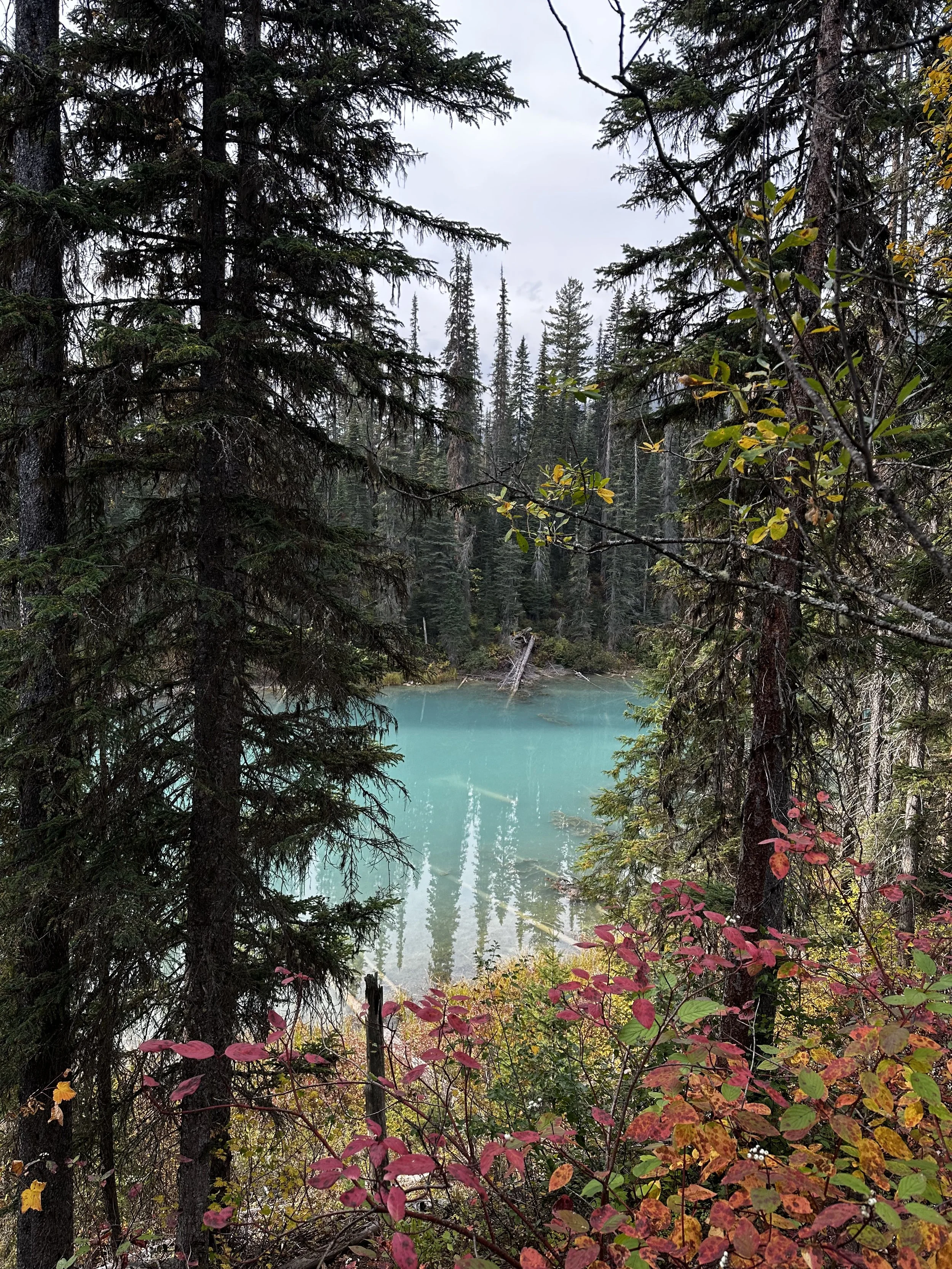
Peyto Lake secret lookout
In the fall of 2025 we travelled north of the border to visit Canada’s first national Park, Banff. We made a roadtrip of it, visiting Calgary, Golden, Revelstoke, Jasper, Yoho National Park, Glacier National Park (the Canadian one), and the Icefields Parkway. Why did I call it the Banff gold rush? Well, it’s because it started to feel a lot like reading about the California gold rush of 1849. We felt like everyone knew someone who packed up and headed west. As we started planning the trip in the spring, we kept running into people that were also headed out to Banff, my parents, our doctor, a co-worker, even my dental hygienist! Just like the experience of many of those 49ers, the only gold we’d find was on the changing leaves of this amazing landscape, but we’d all certainly be making shop owners, hotel owners, and other retailers rich.
Here you’ll find our day-to-day, but I’m also going to write up the parks in a little more detail soon. The planning for the trip was both easy and inundating. There’s no lack of information about this area from locals and travel bloggers alike, determining what was best for us was the hard part. We’d decided to spend the first weekend in Calgary, exploring the breweries and a war museum before making our way to Banff. Miranda had registered for a conference that took place the first week we were out there and I worked from the hotel room. This meant that our first week of hikes would need to be the shorter and closer to the town of Banff. We’d then have a full 7 days to explore with no restrictions, moving first to the town of Golden and then out to the Saskatchewan River Crossing on the Icefield Parkway before returning to Calgary and flying home.
Day 1
We flew in late on a Friday night and got a hotel near the airport. This was both good and ended up being a bit eye opening later in the weekend. On the way out of the airport, we purchased our Discovery Canada passes. You can get these at the park entrance, but it saved us from having to wait in line at the gate by picking them up at the information desk near baggage claim 7. This was also along our route to the rental car center, so it was a good thing to have known.
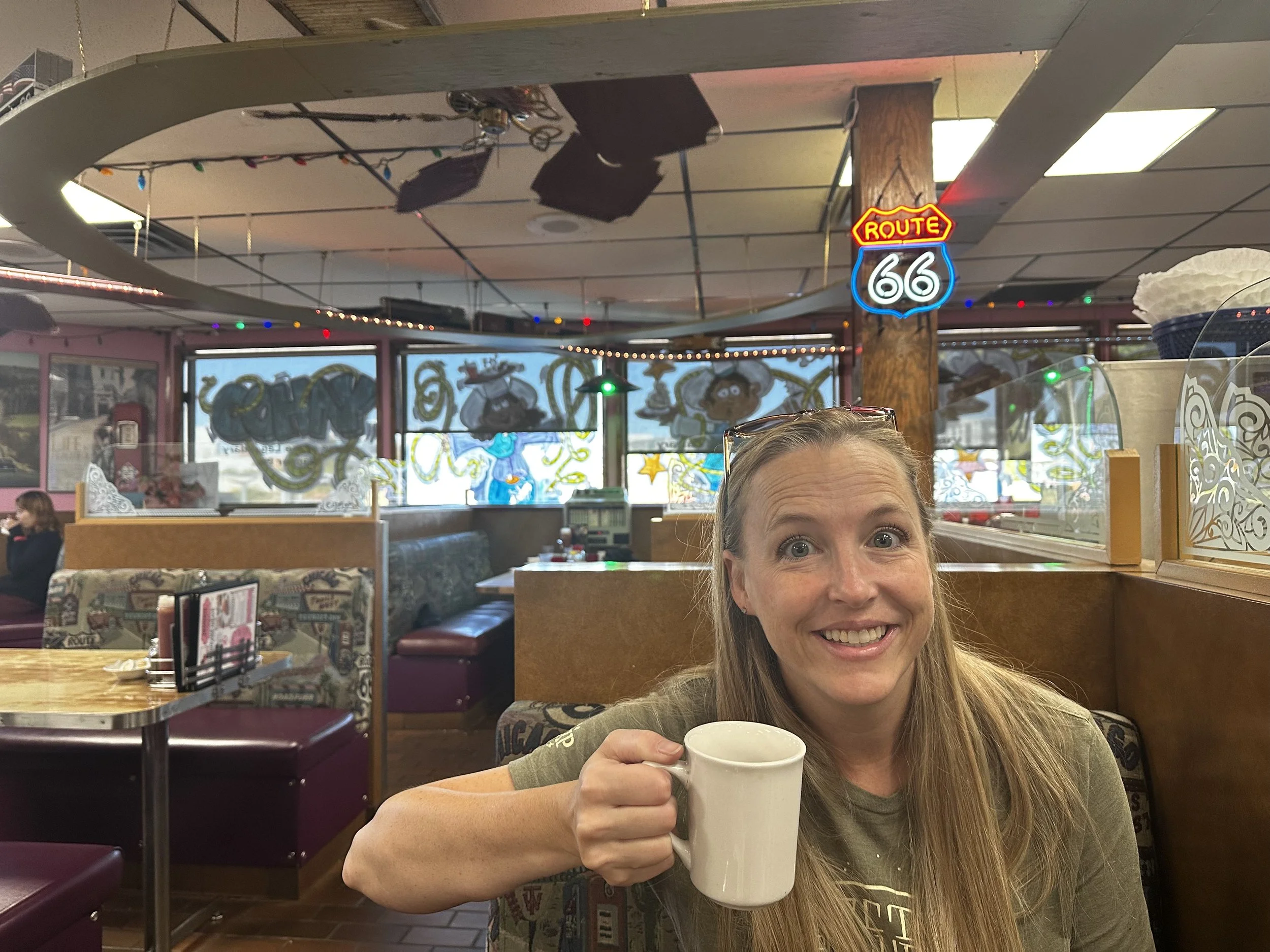
The official first day started with breakfast at the Blackfoot Diner, a local landmark for being the first trucker diner in the area, decorated with Route 66 and local rodeo memorabilia. The food was good and it felt like we were enjoying something a little off the beaten path. You likely wouldn’t even know this place was here if you’d driven right by it because of it’s orientation off the main road a bit.
Our next stop was The Military Museums. This museum covered the history of the three services of the Canadian military and highlighted the four local regiments that have answered the call since the Boar Wars in the late 19th century. One of the most interesting exhibits they had was a small recreation of a prisoner hut and tunnel used during the escape from Stalag Luft III during the second world war that was made famous in the movie The Great Escape. There was also a room dedicated to the men who served in The Devil’s Brigade, made up of American and Canadian troops that were also made famous by a movie of the same name.
Tanks outside the museum
Recreation of the tunnel at Stalag Luft III
Trenches of the first world war
Once we’d gotten our cultural stop out of the way, it was off to the breweries. We had four breweries on our list, but the last one was closed for a private party:
Buffalo 9 Brewing - Not far from The Military Museum, this military themed brewery had some really good beers and a friendly couple manning the place. The Fighting Season Lager was a favorite but their IPAs were pretty good as well.
Last Best Brewing - This one downtown was a little more restaurant than brewery. Miranda really liked the Korean Fried Chicken sandwich but the beers were just so-so.
Banded Peak Brewing - This brewery had the feel of a pop-up concept with it’s garage door entrance and modular walls. That’s not taking anything away from it, the beers were good, but their flight pours were 8 oz, so you’ve got to commit to it.
Dinner was going to be at Tool Shed Brewing & BBQ but they were closed for a private event. This really sucked because we could smell the BBQ from outside. With a little extra time to kill, we decided to head to Walmart for our dry goods for the rest of the week. This place gave ‘People of Walmart’ a run for its money. After getting our snacks, drinks and pharmaceuticals, we were out the door and looking for dinner. We settled on a pizza from Vern’s Pizza that was honestly one of the worst pizzas we’d ever had. Pizza is always a safe fallback for us; we almost always get one everywhere we go, but the sauce tasked like ketchup and there was a layer of what looked like lunch meat ham under the cheese. It would have been a sad way to end the day, but we stayed up and watched St. Louis City SC beat San Jose on our little iPad screen before turning in for the night.
Last Best Brewing
Banded Peak Brewing
Day 2
Sunday in Calgary was going to be a lazy day. Our only goal was to be in Banff at or around 4 pm for check-in. We had breakfast at Ricky’s & Famoso and this was a cool little find. They had a massive Big Brunch Platter that fed us both! We got rolling towards Banff with our first stop being Canmore to check out their tourist trap of a main street and a couple of breweries. 8th street in Canmore is blocked off during the day, not sure if that’s just on weekends or full time. There are a number of restaurants, souvenir shops, art galleries, and other little shops to buy stuff along the way. We scoped out a few things that would be cool if we don’t find anything better throughout the week and then headed for the breweries.
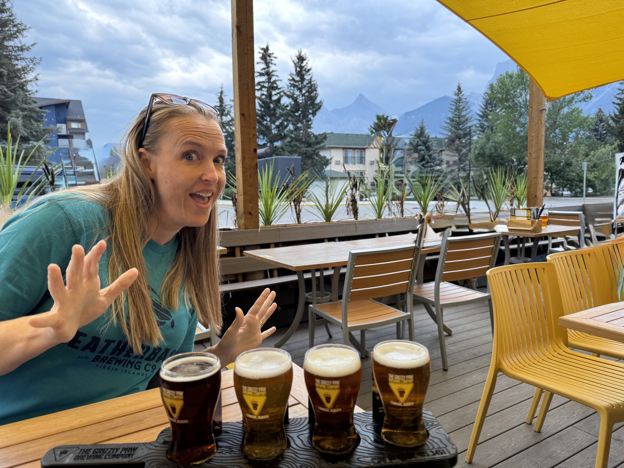
Canmore Brewing Company - On the backside of a small shopping strip, this inside/outside brew pub had some good beers and shirts that featured The Three Sisters, a mountain formation that can be seen all through town.
The Grizzly Paw Taproom - This was our only other brewery stop in Canmore. We got another flight but also tried their spicy tots. These hit the spot since we weren’t hungry hungry but we definitely needed something to go with the beer.
Back on the road, we stopped for pictures at one scenic lookout, but for the most part we just pushed through to Banff. Because we had our passes already, we were able to bypass the gate entrance line and go straight to the Dorthy Motel. This was a reasonably affordable option in a town full of high-end ski resort type facilities. The Dorthy is owned by the same folks that run the brand new Hotel Canoe & Suites across the street. That’s where we had to check-in and we were also able to use their hot pools! We were also able to borrow bear spray from the front desk, this would save us about $50 since you can’t fly home with the stuff, it ends up being a waste to buy it if you don’t use it. Once checked in we collected our free bus passes and caught the Rome shuttle downtown to get a feel for how the buses worked and start our wanderings. We ducked in just about every souvenir shop, again, looking for that perfect hoodie, shirt, or hat. Banff is completely surrounded by mountains, between that and the cloud cover, it felt like it was getting dark pretty early. We made it into the Three Bears Brewery to try their stuff and revisit Canadian pizza. Luckily we weren’t disappointed by either offering. Three Bears Brewery ran more like a restaurant. We might have needed reservations, but luckily the hostess told us she had a table open for a little more than an hour and we assured her we’d be gone in time for the reservation.
We walked over to the bus stop and waited for about 10 minutes as it began to rain. This was a reminder that we needed to be carrying our rain gear with us at all times.
The Sign
Dorothy Motel Room
Three Bears Brewery
After the rain in Banff
Brink of the Lower Falls, Grand Canyon of Yellowstone
Day 3
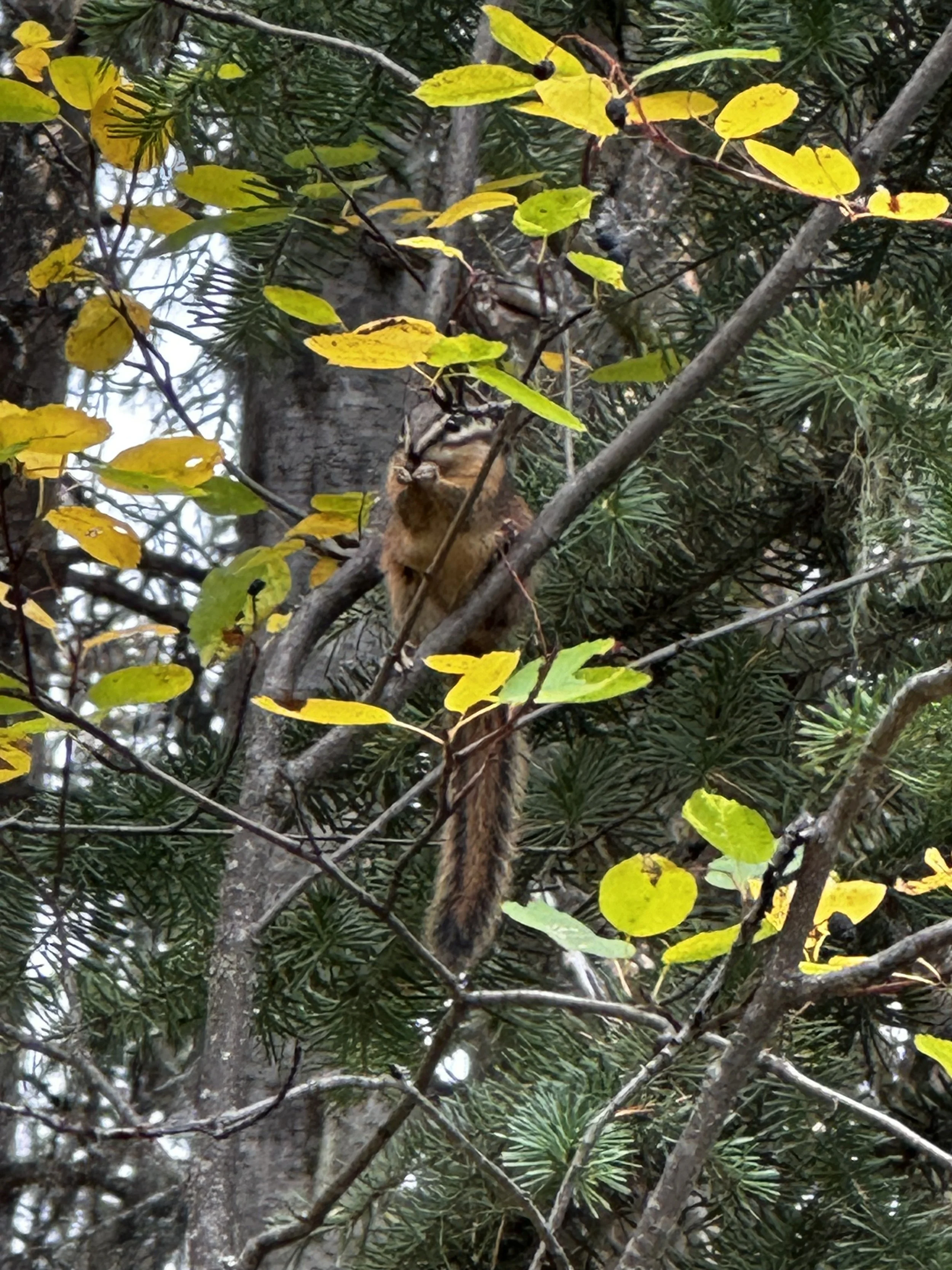
Our first weekday started the way most weekdays start, with work…. BOOO! Oh well, I dropped Miranda off at her conference location because it would have cost $9 an hour to park there!!! That seemed excessive but helped contribute to the feeling of being gouged during the gold rush. I grabbed breakfast at Tim Horton’s on the way back to the room and worked from my mobile work kit for the rest of the day. Miranda took the bus back to the hotel, and after eating a late lunch, we headed out for our first hike. For this one, we’d backtrack a bit to Canmore for the Grassi Lakes trail. This trail was about two miles round trip, but it’s all uphill for the first half. We started to feel the roughly 5,000 ft altitude for the first time as we walked up. The payoff was worth it as we rounded the upper lake that was initially as smooth as glass. We got a lot of great pictures with Ha Ling peak in the background. We got a few pictures at the lower lake before beginning the descent. Wildlife was scarce with the highlights being a squirrel and a couple of the very large crows wandering around the parking lot. For dinner, we parked back at the Dorthy and took the shuttle downtown to Banff Ave. Brewery. Here we had some excellent fish and chips and an Aussie chicken parm, both of which became leftovers for dinner later in the week.
Clear water of Grassi Lake
Grassi Lake and Ha Ling Peak
Us at Grassi Lake
Selfie at Grassi Lake
Miranda posing
They can’t all be selfies
Day 4
Another day of work, another car trip to drop Miranda off at her conference, but on the way back I caught site of some elk hanging out in the park near the Fairmont Banff Springs hotel. I got a couple of quick pictures of them and the sunrise, got breakfast at Tim Horton’s and got back to the hotel room for work. At the end of the day, we were off to Johnson Canyon trail. This one was a little longer than the previous day, 3.5 miles out and back and again mostly up for the first half. The big difference is that this hike ran along Johnson Creek and had a number of sections with scaffolding along the cliff walls. We approached the lower falls at about the half-mile mark but decided to skip it because the draw appeared to be a small tunnel that came out at a secluded picture spot, which had a pretty long line to get to. We found out later that the pictures from down there were pretty underwhelming because you end up pretty close to the falls and can’t capture much context. We passed several other smaller falls as we made our way to the top, the entire hike stays within site of the creek, so we never lost the sound of running water through the rock formations. The Upper Falls was a little more spectacular but a little bit of a disappointment from a picture perspective. The only way to see the bottom was to walk down a scaffold path and the only clear shot of the falls was the one spot at the very end. Luckily, we got there as a crowd started to build behind us, so we got our shot and proceeded on the path to the top of the falls. The pictures were much better towards the top, rewarding us for taking the last few uphill steps. The walk back was pretty uneventful.
Johnson Canyon Upper Falls
Boardwalk over the river
One of the many unnamed falls along the trail
We dropped our backpacks off back at the Dorthy and took the shuttle downtown to Sheepdog Brewing for a flight and some merch. Miranda found a sweatshirt she liked and then she talked me into a t-shirt that I was debating getting. For dinner, we stopped by Tommy’s Neighborhood Pub, an Irish joint that’s in the basement of Cascade Hall. The food was ok, Miranda got the fish and chips again and I got the chicken fingers but we’d had better of both of those on this trip, oh well, you can’t win them all.
Sheepdog Brewing Flight
Day 5
This was an early early day for us; we were up at 4:30 am to catch a 6 am shuttle to Lake Louise. This was a big one for us, probably the most amount of planning for this trip went into this one day. There is very little parking, and it’s first come, first served. Other options are to get a Roam ticket or book a private tour. We’d missed the initial opening period for the Roam ticket and had a few backup plans if we missed the final one, but we managed to get our passes and made it up to the lake in time for sunrise. The bus ride was only about 40 minutes, and we got to the shoreline with enough time to find a good spot, setup our selfie stick for the time lapse, and then just defend our ground for the next hour and a half.
Lake Louise with the sun hitting the peaks
Lake Louise after sunrise
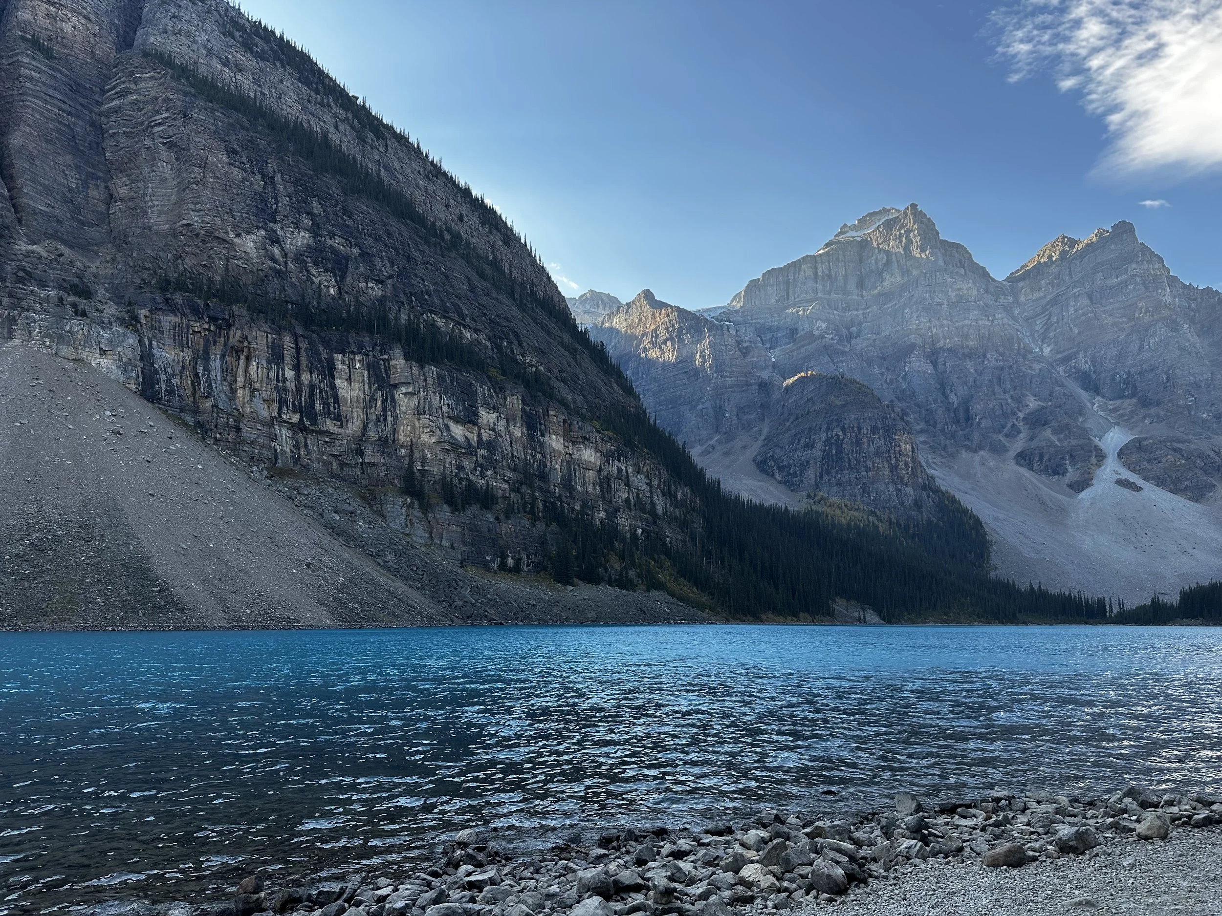
After we’d gotten all the pictures we could want, we started to debate how much longer we should stay. At just about that same time, someone decided to walk into the view of phone running the time lapse video and that decided it for us. We packed up and headed to the parking lot to catch the shuttle to Moraine Lake. The bus was fairly empty, and the driver entertained us with some facts about the area during the 20-minute drive. Our first stop was to head towards the Rock Pile, a built-up berm at the north end of the lake that provided some of the best pictures of our trip.
Path to the Rock Pile
Rock Pile

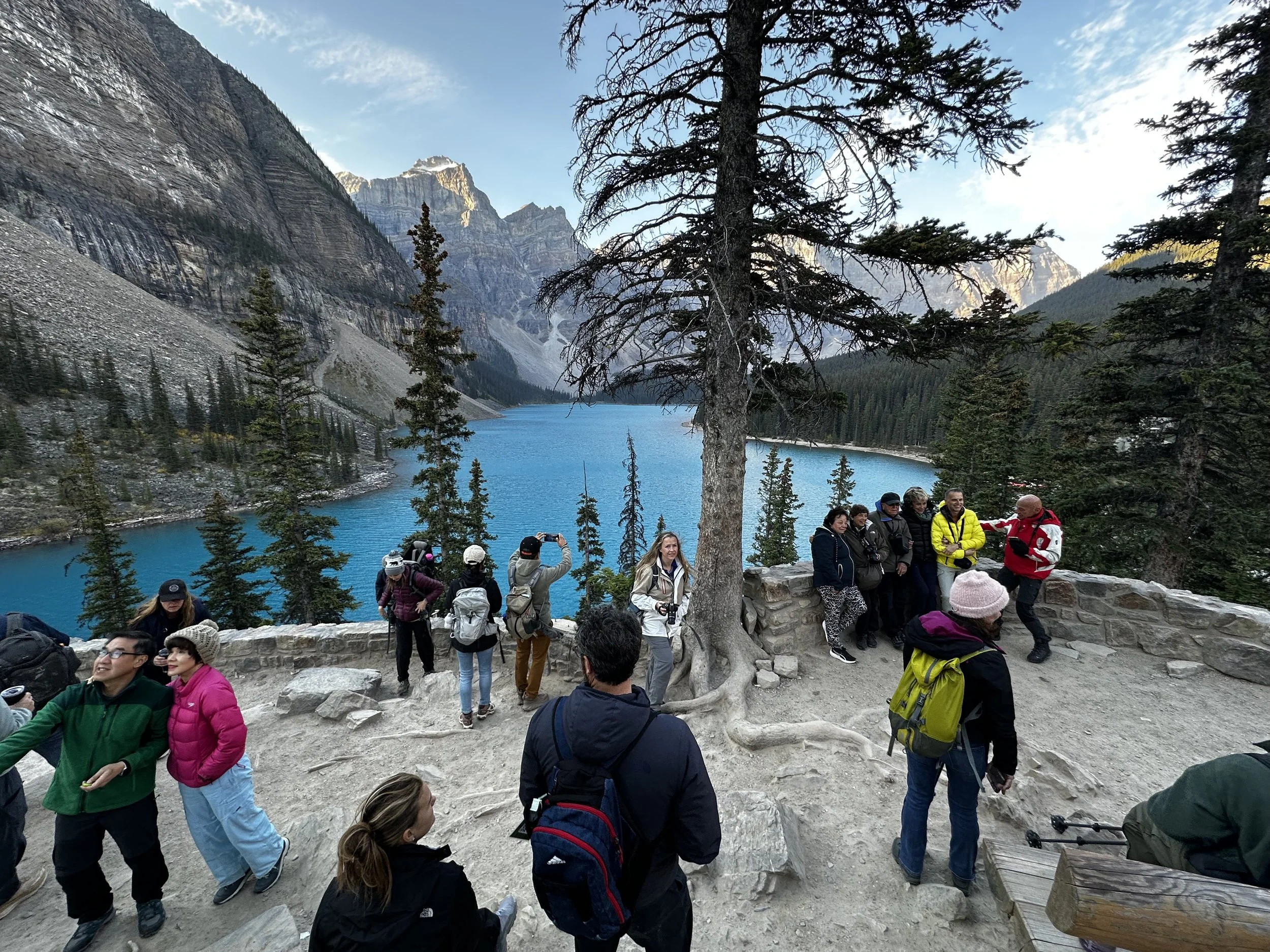


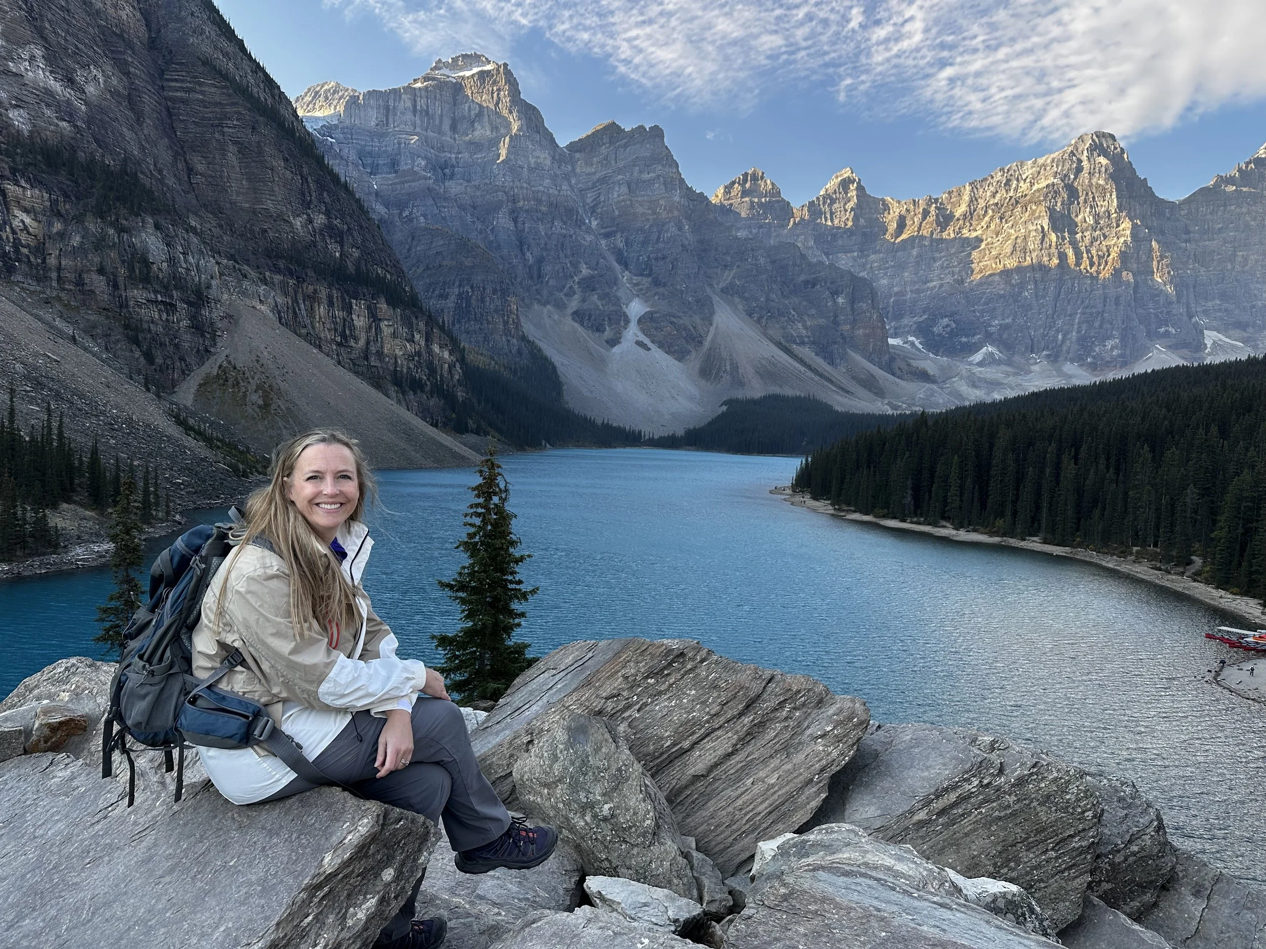


We took pictures from several vantage points before heading back down along the shoreline. The shoreline trail took us down the west side of the lake and all the way to the glacier fed stream that empties into the lake. We stopped for pictures and then lunch here and just enjoyed the view as the sun came over the mountains and turned the lake an electric blue. As we made our way back to the buses, we looked up at the top of the Rock Pile and it was packed. We were feeling good about having gotten up there early.


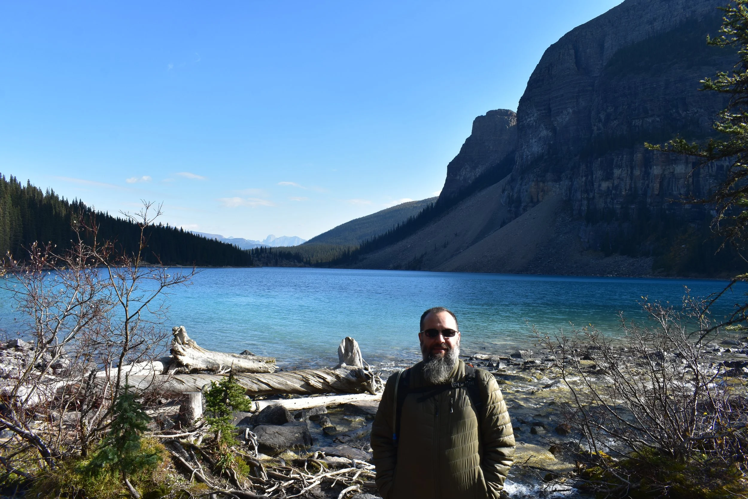

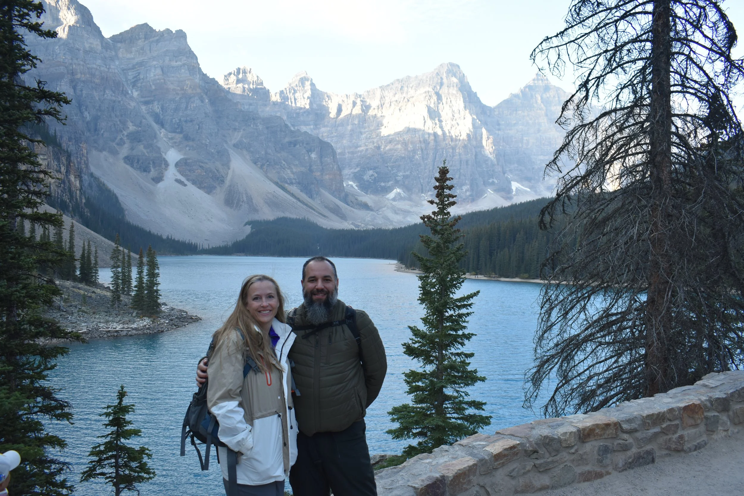
Back at Lake Loraine, we took the shoreline hike around to get some views of the rest of the lake and the hotel perched at the end. We considered staying at this hotel for one night to get a jump on the crowds, but at anywhere from $1200-1800 a night, we just couldn’t justify that! The crowds had really picked up at this point, so there wasn’t really a spot to just sit and enjoy the view in peace. We got our pictures and then made our way back to the parking lot and caught an earlier shuttle back. We didn’t do any of the hikes that had any real elevation to them because it felt like we’d just be climbing to get a better view of the lake with the giant hotel on the shore.
Fairmount Chateau
Lake Louise
On our walk back from the bus stop, we dropped in on the IGA to check out their prices and see if they had any wine. We noticed that the prices weren’t all that different than what we had seen in Calgary, so there was one place that wasn’t going to gouge us just for being in a tourist spot. They didn’t sell alcohol, so we stopped at the liquor store on our way back and grabbed a bottle from Pyramid Winery in British Columbia. It was a red blend that was pretty good, we might have to look that region up for our next wine trip. Since this was the earliest we’d been done hiking all week, we decided to head next door to the Canoe Hotel & Suites, which is owned by the same management group that owns the Dorothy. Here we were allowed to use the hot pools to soothe some aching muscles. We had the place all to ourselves for about an hour before we headed back for some wine and leftovers for dinner.
Hot Pools at the Canoe Hotel & Suites
Day 6
We were back to our usual schedule of dropping Miranda off at her conference, me stopping at Tim Horton’s, and then working from the hotel. We saw the elk again on the way up and got a couple of good pictures. That afternoon we set out for the Tunnel Mountain trail for a 2 mile roundtrip hike that included 800 ft of elevation gain. The payoff at the end was an overlook of Banff and the surrounding mountains. We took plenty of breaks on the way up because this hike just didn’t seem to let up. There was a little bit of a haze in the valley, we had smelled smoke earlier, so it could have been from one of the numerous fires the region had this year. We also ran across our first set of red chairs. These are all over the area but we hadn’t spotted any yet. Unfortunately there was a couple occupying them and they didn’t get up the entire time we were at the top, so we got our pictures and moved on. For dinner, we stopped at the Canadian Brewhouse and enjoyed the view of Banff Ave and the mountains in the background. The food was good and they had a number of local beers on tap.
Big Elk buck in Banff
Red chairs at the top
Mule Deer
Bow River from the Tunnel Mountain Trail
Our view from the Canadian Brewhouse
Day 7
Today was moving day, eventually. We started with our usual routine of me dropping Miranda off at her conference, but on my way back to the Dorothy, I was greeted by a huge herd of Elk in the spot I’d become accustomed to spotting a few of them at. Because we’d already started to pack the car up, I had the big camera and the 300mm lens available. The large male bull of the herd seemed to be staying on the periphery, and I soon realized it was because he was pushing the herd across the street up a hill away from the river. This meant they would walk right past me. I stayed at a respectful distance as one by one they descended the small hill towards Spray Ave, right at the intersection of Bow Falls Ave and crossed in front of me. The bull crossed the Bow Falls Ave and stayed at the corner until almost all of the herd had crossed. Once he got across Spray, he waited but finally had to let out a loud bulge that caused the last female and her calf to hurry up. After a few minutes they were mostly out of sight.
Once the conference was over and we were checked out of the Dorothy, we made a couple of stops in town that we hadn’t had a chance to visit yet including the Cascade of Time Garden, Bow Falls Viewpoint, and then BeaverTails back in town to try one of their products by the same name. These thin fried pastries are a conduit for getting the toppings into your mouth and they were delicious!
Cascade of Time Garden
The view from our near bear sighting, just past Wild Goose Island Lookout
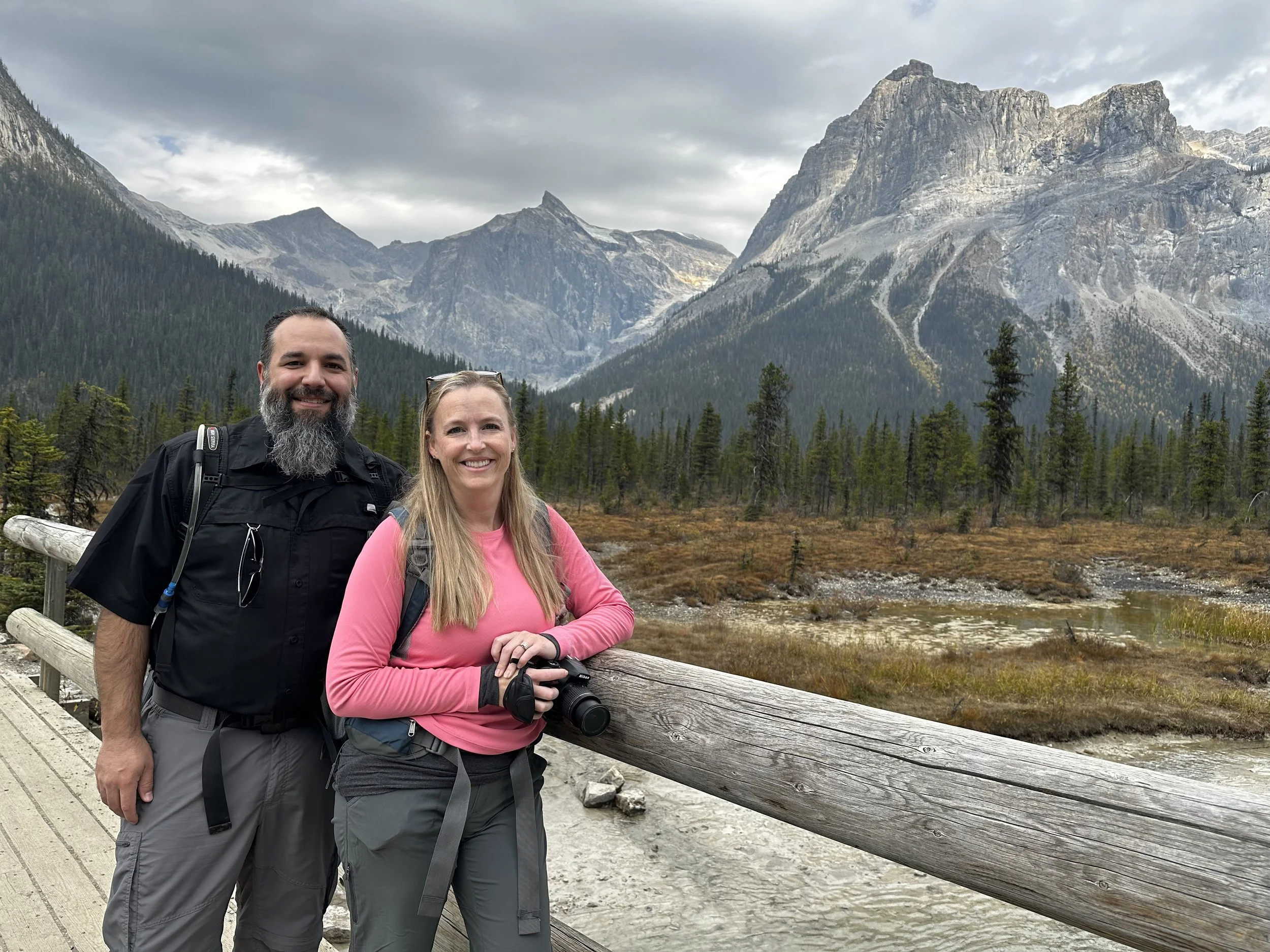
The drive out got a lot less crowded once we turned west. Highway 1 from Canmore to Jasper is the area most frequented by tourist, every stop was inundated with tour buses and rental cars, and we weren’t even there during the high season! The only stop we made on the drive to Golden was Takakkaw Falls, which is just inside Yoho National Park. Although the falls are just a short walk from the parking lot, the drive from the highway to the lot took about 20 minutes. At over 1200 ft high, Takakkaw is the second tallest waterfall in all of Canada. The path from the parking lot leads down the river a bit to a bridge, and then a short walk up to near the base. There are several spots along the way to walk down to the water for pictures and then one very obvious area that most people stop at for selfies before turning around.
We continued on to Golden but we got there too early for our 5 pm check-in so we headed downtown for some beer. The only brewery in town is Whitetooth Brewing, which had a number of interesting options and menus from other restaurants that delivered food. We tried to order a pizza but it wouldn’t be delivered for over an hour and a half so we scrapped that idea, drank our beers, and tried an ole reliable option, Ricky’s. As we walked in, we learned this was their last day of business after nearly thirty years so we settled for an option just down the street, Pint + Fork. Although the beer selection here wasn’t as great, the fish and chips were excellent! As had been a common theme on this trip, we split dinner by ordering a second filet and were both very satisfied with the outcome.
After dinner we checked in to our home away from home for the next five nights. We didn’t meet our host right away, but the lady subbing for her showed us around and explained the breakfast process, where to park, and showed us our private room with its own bathroom. There was also a hot tub that we could use at any time. B&B’s can sometimes be a crapshoot when you’re sharing space with the host and other guests, but we could not have been happier with this pick. If you’re looking for it on Booking.com, it’s called Canyon Ridge Lodge. You’ll read more about it over the next several pages because we really did enjoy our time staying here.
The awesome fish and chips at Pint + Fork
Day 8
Our first full day in Golden and we got to sleep in a little bit, but not too much. Our host offered breakfast between 7:30-8:30 and we had a lot of driving ahead of us today. Breakfast here really blew our expectations away. Around a table that seated twelve, our host had cereal, coffee, tea, juice, milk, and fresh fruit. She also prepared eggs with toast or English muffins. This morning, we learned that the two other couples in the rooms next to us were both there to attend the same wedding. They’d met the night before at a reception for the guests but had arrived at different times and didn’t realize they were staying in the same place.
Breakfast spread!
We finished breakfast and set out for Revelstoke. Our host had warned us that many of her guests over the past few weeks said traffic had been stopped for long periods of time as road crews dynamited sections of the cliff near the road for work that was being done. We made it through the first construction site with no issues before stopping at Hemlock Grove Boardwalk.
Hemlock Grove Boardwalk is right off the highway and is only about a quarter of a mile, but it’s great on a wet day like it was for us. This trail was our first one in Glacier National Park. The wooden boardwalk keeps you off the ground and out of the mud while walking through the forest. We didn’t see much for wildlife but it was good to get out, stretch our legs, and read a little bit about this area on the signs along the way. This would have been completely redundant if we’d done Giant Cedar Boardwalk first, but with the weather, we were happy to take any opportunity to get some steps in.
Our next stop was the Giant Cedar Boardwalk, which is supposed to be a loop, but at some point recently a few trees came down and destroyed a section of the boardwalk. This stop was our first one in Mt. Revelstoke National Park. The cedars here are very impressive and offered a number of cool photo opps. Still no wildlife but the pictures were good and it was another chance to stretch our legs.
I couldn’t help but wonder if we’d stayed at one of our last two stops just a few minutes too long, because after less than a mile back on the road we ran into a line of cars. We were close enough to the front to realize that we’d only missed the window to get through by a few minutes. It took about a half an hour before the road crews cleared the debris from the dynamiting they were doing ahead, presumably to widen the road. We pressed on through to Revelstoke and drove through town before proceeding to the Mt. Revelstoke National Park entrance. Even though we would end up traveling to five different national parks on this trip, we only passed through a handful of park gates. The honor system seems to be in effect in most areas where access can’t be as easily enforced. The pictures we had seen led us to believe that we’d get an amazing view from the top, but we tempered our expectations, given the thick cloud cover in the area. It was hard to tell, but we likely only made it about halfway up before we couldn’t even see the trees on the side of the road anymore. We turned around and got pictures from a couple of the overlooks before making our way to Mt Begbie Brewery for a snack and some beer. The beer was pretty good but some of the merch designs really stole the show for us. Unfortunately, it was pretty late in the season, so they didn’t have our favorite shirt in a size or color that we really liked, but we did end up getting matching hoodies.
Hemlock Grove Boardwalk on a rainy day
Giant Cedars and normal people at the Giant Cedar Boardwalk
Stopped for dynamiting with the misty mountains all around
This was the view when we decided to head back down
The best view we could get of Revelstoke
We made two stops on the way back and the two hikes couldn’t have been any more different. Our first stop was Meeting of the Waters trail, a nearly 1 mile flat loop that led to a violent collision between the Asulkan Brook and the Illecillewaet Rivers. The hike passes through heavily wooded areas with openings that have the remanence of some of the early glacier houses in the area. Where they meet has a nice little opening with some chairs and a bridge to enjoy the sound. The entire area has moss/lichen covered trees and rocks in a forested scene straight out of a fantasy novel; we were just glad there were no bears.
After a short drive, we arrived at the trailhead of our second hike, a .8 mile long, straight down and then straight back up trail. At the bottom was a pretty solid waterfall, but as we approached it, we realized we’d left our bear spray in the car. This made the rest of the hike interesting as we continued to look around hoping we didn’t get cornered on the path. On the drive home we ordered pizza from Turning Point Restaurant, it wasn’t awful, but it wasn’t our favorite of the trip. Luckily we also stopped at the liquor store and had grabbed a couple of bottles of British Columbia wine. The first bottle was so-so, but the second one was good enough that we went back for more!
Bear Creek Falls
This path felt like it was nearly straight down
Day 9
For our second full day in Golden, we decided to do Quartz Lake trail, a fairly long trail with a pretty solid incline to a beautiful lake in the mountains. We started the morning at breakfast again; this time our companions were a Swiss couple and a couple from Ontario. Breakfast was excellent again and we were out the door for our hike. We knew that the sign for Quartz Lake was right off the highway and were feeling comfortable enough in our directions that we didn’t use GPS. This turned out to be a huge mistake. The one thing we didn’t notice on our trek the day before is that the Quartz Lake turnoff is in an area where the highway is divided. Having blown past the sign and being free of any construction delays due to it being a Sunday, we managed to make it nearly 40 miles down the road before agreeing that we had to have missed it. Annoyed at ourselves, we turned around and started heading back. The one thing you have to think about on some of these roads is gas, and although we thought about it before leaving, we hadn’t taken into account the extra 80 miles we had just put on the car. We started to monitor the range closely as we approached the Quartz Lake trailhead and decided we needed to be very careful on the drive home so that we didn’t find ourselves on E.
One of many we had to climb over/under before we called it
Quartz Creek near the trailhead
The Quartz Lake hike started with a really steep incline on a poorly maintained trail. After a third of a mile we stopped to think about what we had done. It took us 45 minutes to go a third of a mile and climbing only about 300 of an expected 1900 ft. of elevation. We’d also had to navigate five trees that were down on the trail. Some quick math told us that we’d likely still be out here by the time it got dark and we abandoned our plan to go back to the car to tackle our gas problem. The range estimation that our little VW Taos was giving us didn’t make us feel great as it fluctuated between 45-50 kilometers. With no cell signal, we had to estimate how long the drive back to Golden was, we found out later that it was 46.5 kilometers. In order to give ourselves the best chance and reduce gas consumption on the worst part of the trip, we started the car and put it in neutral on the drive down the forest service road back to the highway. This saved us from using gas for a little over 5 km. Once back on the highway we put the car back in neutral during every long downhill straight away and we made it back into town with a little under a gallon left in the tank. We finished the day off with a more leisurely drive out to Thompson Falls, dinner at The Island restaurant, and a walk down the river to the Kicking Horse pedestrian bridge.
Blaeberry River at Thompson Falls
Kicking Horse Bridge
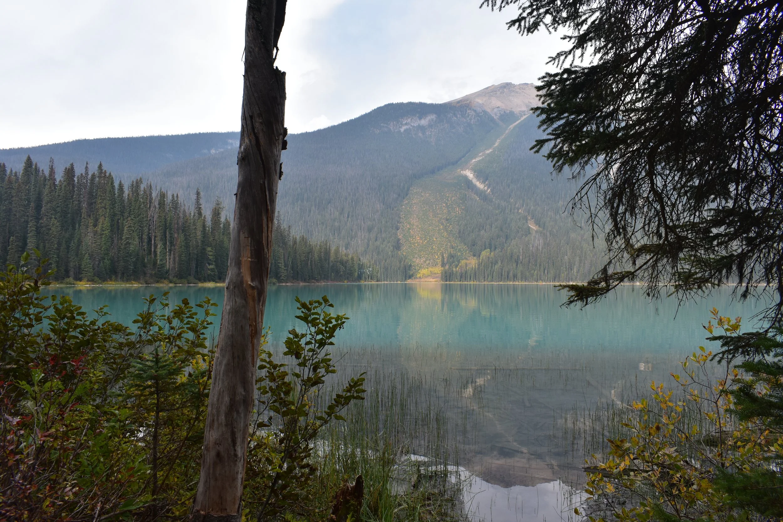
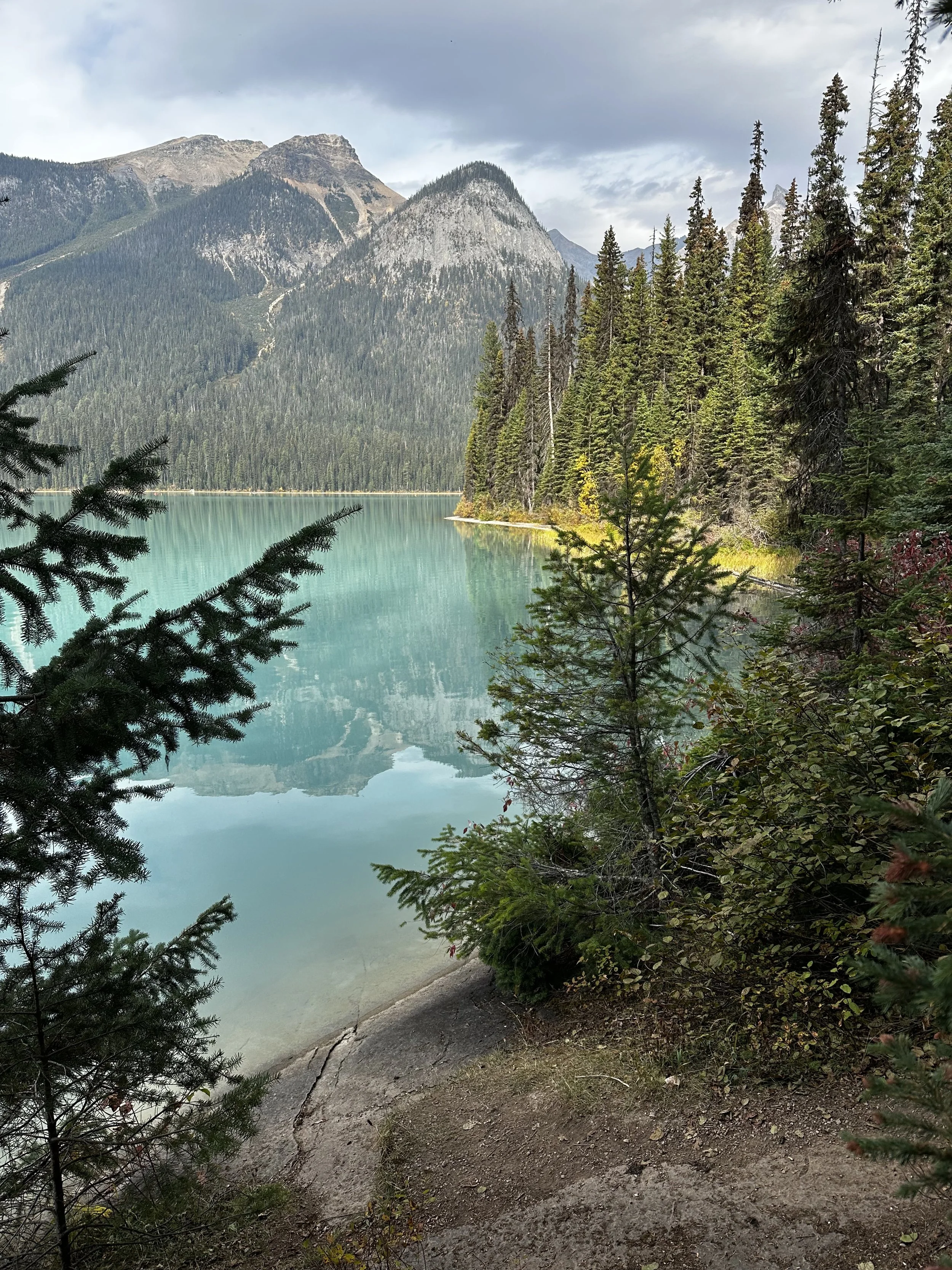
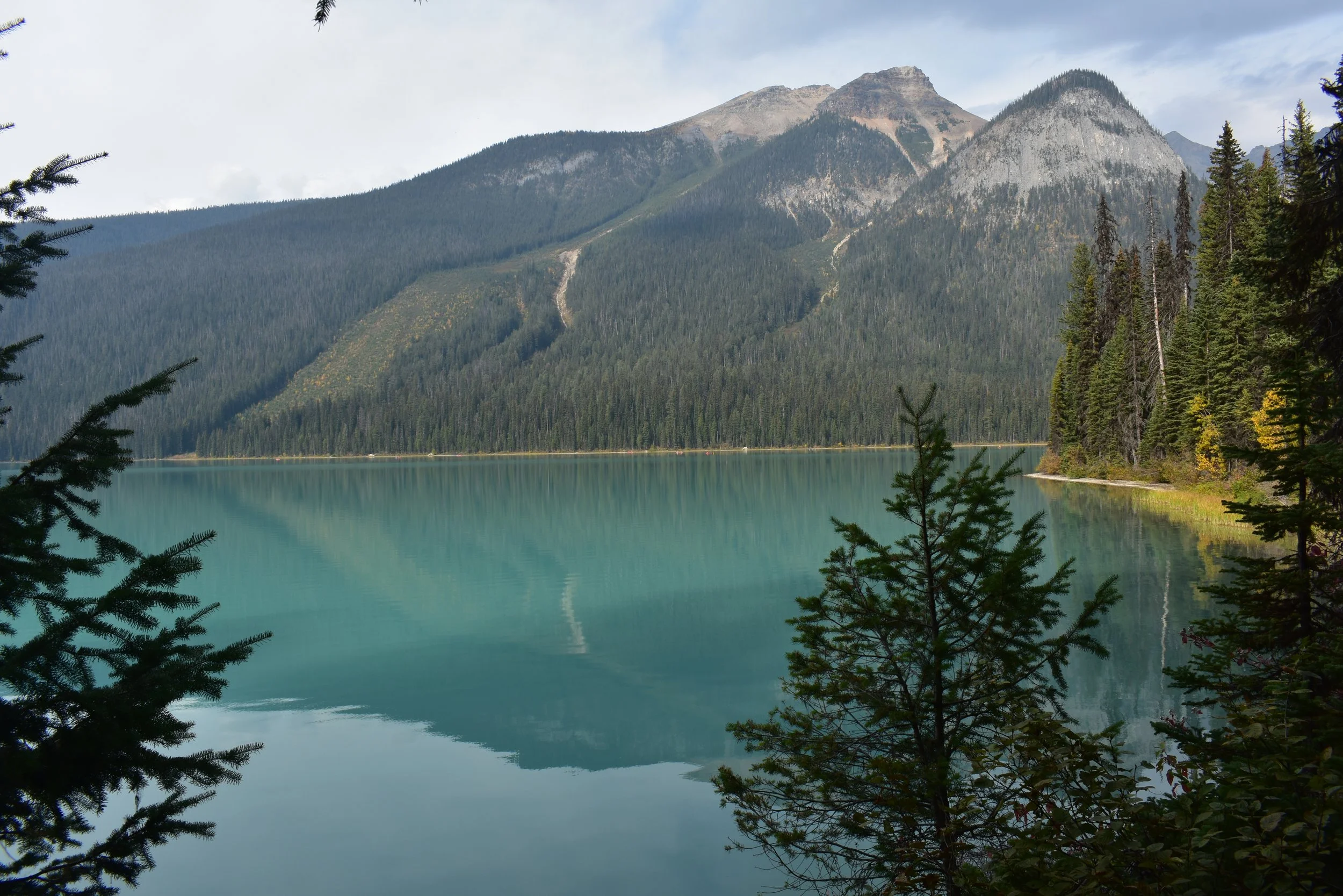
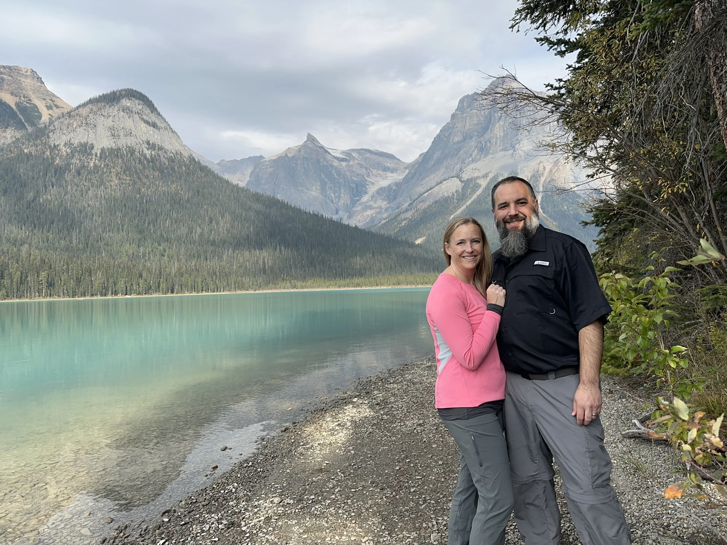
Emerald Lake
Day 10
We’d been monitoring the weather pretty closely to make sure we picked out the right day for our next hike. Emerald Lake in Yoho National Park, as it sounded, had a beautiful emerald look to it, but we didn’t want to head there during an overcast day. This morning started a little cool but the forecast called for sun most of the day. The drive took us back towards Banff and we were immediately greeted in the parking lot by tons of cars and RVs along with tour buses unloading groups. We got incredibly lucky to catch a car leaving and we got a spot pretty close. The hike around the lake was only a little over 3 miles with minimal elevation gain. The hike starts at the Emerald Lake Lodge and you can go in either direction. While we were there, part of it the trail was under construction with a new boardwalk going up on the side of the lake that doesn’t seem to get as much sun, meaning more mud. We didn’t run into any problems, other than some obnoxious kids piercing the quite morning.
The lake was very still and reflected the surrounding peaks in its emerald water. Once the sun came up over the mountains, we started to get more color, but the clouds in the area made sure we didn’t get the electric blue we’d gotten at Moraine Lake. At about the halfway mark we crossed the bridge over the nameless glacier runoff stream that feeds the lake and stopped for lunch at one of the benches. The west leg of the lake was less eventful, it’s a well-maintained path and by this time, the sun was up over the mountains and pictures became a little hazier. We walked down to the parking lot and hit the trail towards Hamilton Falls. This didn’t appear to be as popular, and we only saw one couple heading up and a second one as we were headed back. The falls were pretty disappointing; we’re assuming that it’s probably a more seasonal display and its source was low this late in the season.


The drive back included a stop at the Natural Bridge, which was just before we got back to the highway. We were initially greeted by what was becoming a pretty common sight: tourists blowing past signs that said “Do Not Enter” so that they could get that perfect picture, at the expense of everyone else trying to get photos of the feature. In this case a woman walked out on to the rock formation while her husband took pictures of her. The other 50 people trying to take pictures had to just wait patiently, although one Russian tourist let her have it and started yelling. Once the lady moved on, and before anyone else got an idea to do the same, we got our pictures and moved on to the town of Field. This town is just a small rail depot with one restaurant and a small visitors center.
Our last nature stop of the day was a small creek just outside of Golden, where our host had told us she’d seen some salmon swimming upstream the day before. We made our way out and initially only saw one little guy struggling to get past the bridge. But once we went downstream to the other side of the bridge, we saw a dozen Chinook salmon collecting their strength in the calmer waters before making the attempt to join their friend. They weren’t too disturbed by us and we caught them going after one another like go kart drivers trying to run each other off the road. They weren’t the prettiest or the biggest fish, but they were still pretty cool to see!
Our day ended at the Whitetooth brewery again, and this time we managed to get a pizza from Red Tomato Pies, which restored our faith in trying pizzas while traveling. Their pizza was delicious and we even ordered some cinnamon sticks to go with them… you know, just in case.
Day 11
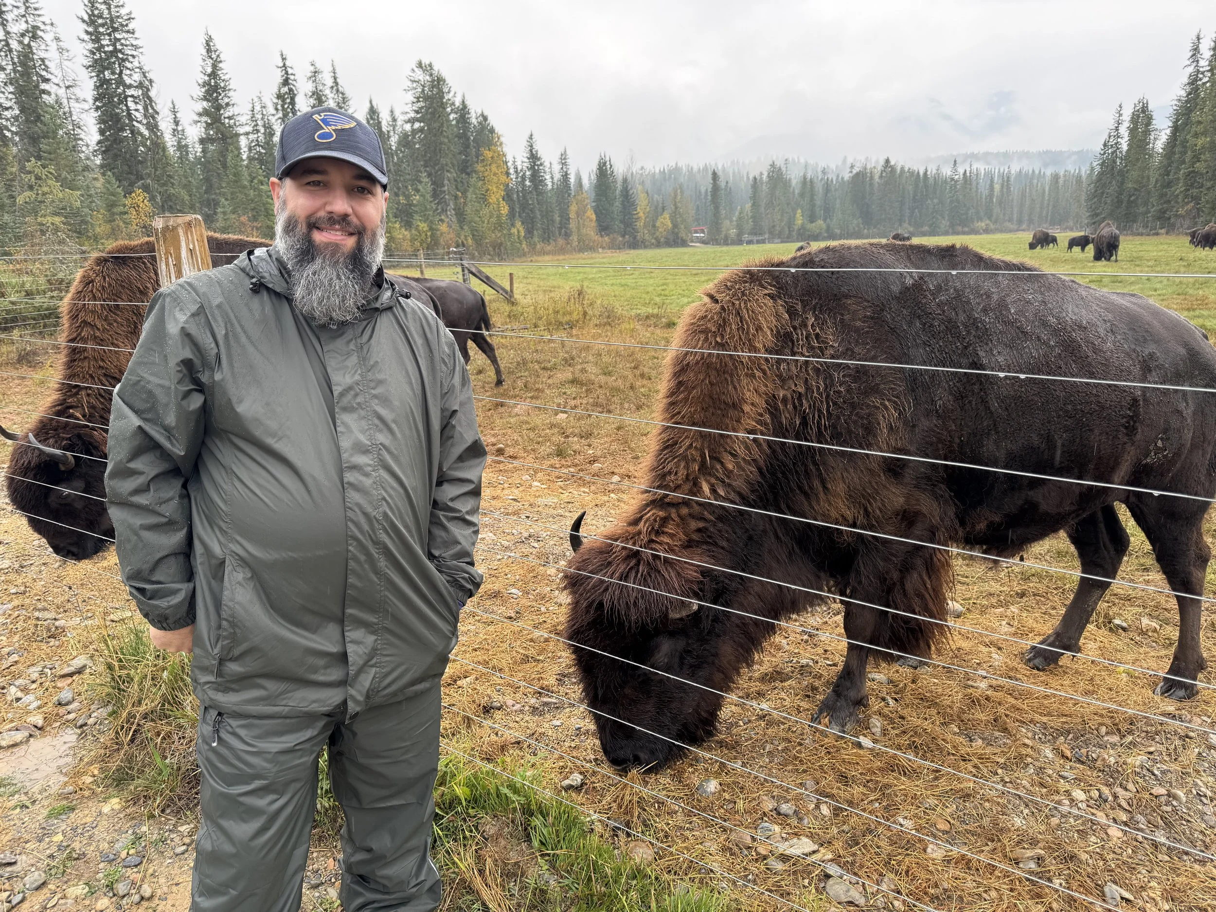
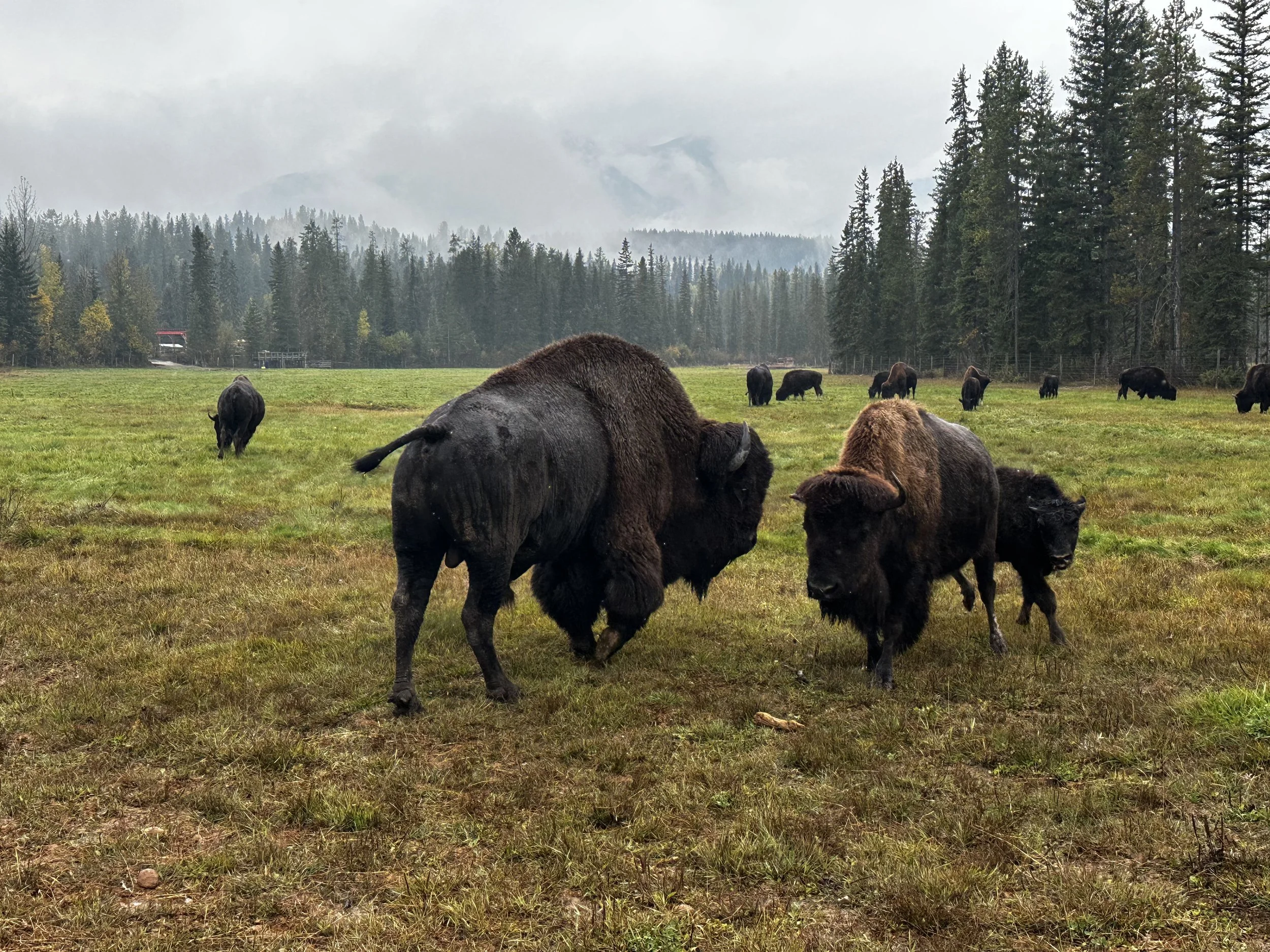
It was great that we got Emerald Lake in the day before because today ended up being another overcast and wet day. We decided to do some of the things around town. There were two options we saw from the highway that felt like tourist traps, but our host said that most folks she’s talked to seem to enjoy them. The first was the Rocky Mountain Buffalo Ranch and the second was the Northern Lights Wildlife Wolf Centre, which just happen to be neighbors. We looked up the Buffalo Ranch and learned that today was their last tour of the season, so we finished up breakfast and hit the road.
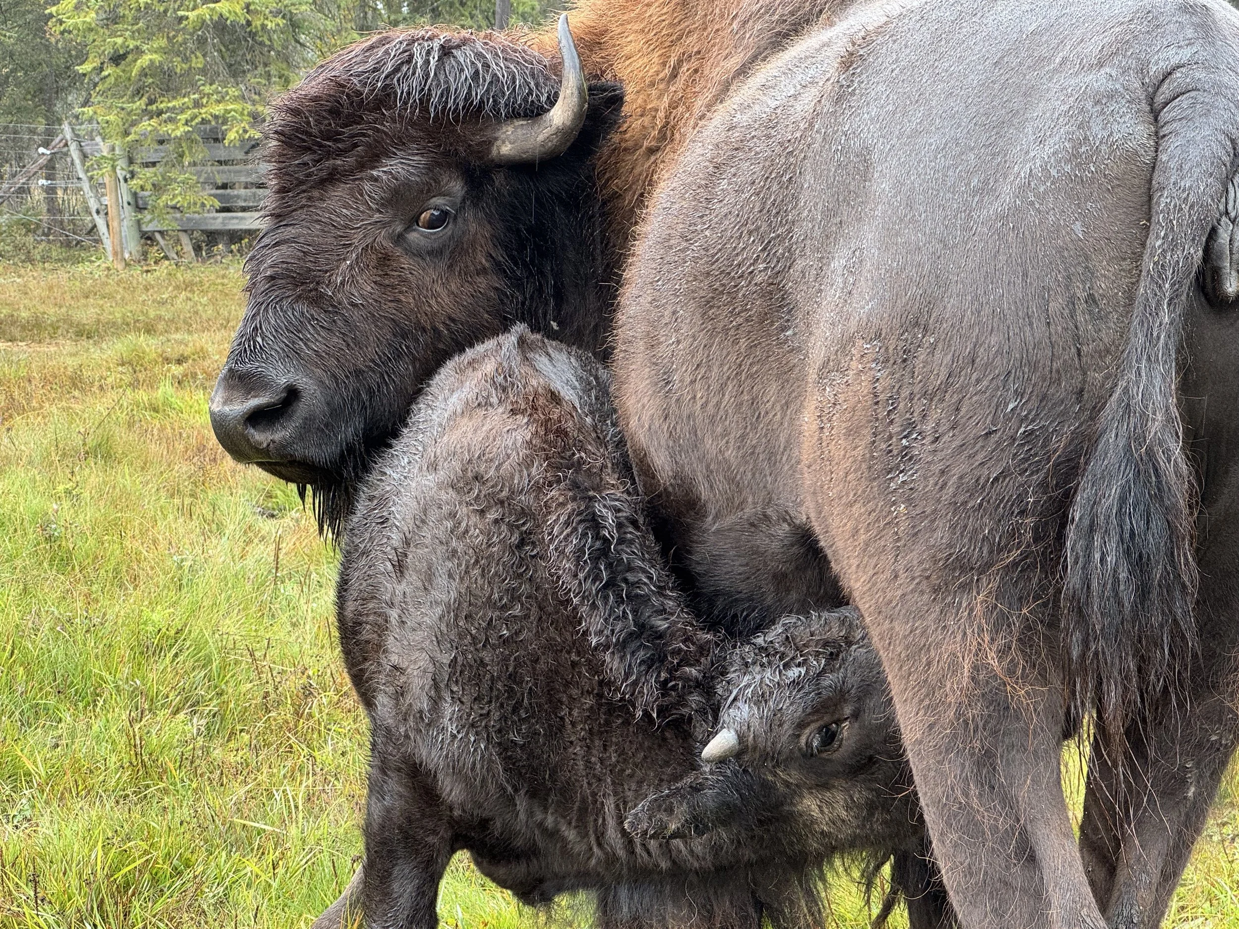
The Buffalo Ranch is run by a man named Leo Downey and you aren’t going to meet a more intriguing man in his field. We spent the first 45 minutes listening to some of his more interesting experiences learning to live off the land, understanding and supporting the relationships between the land and the animals, starting a folk band, and his experience running a buffalo herd for nearly 30 years.
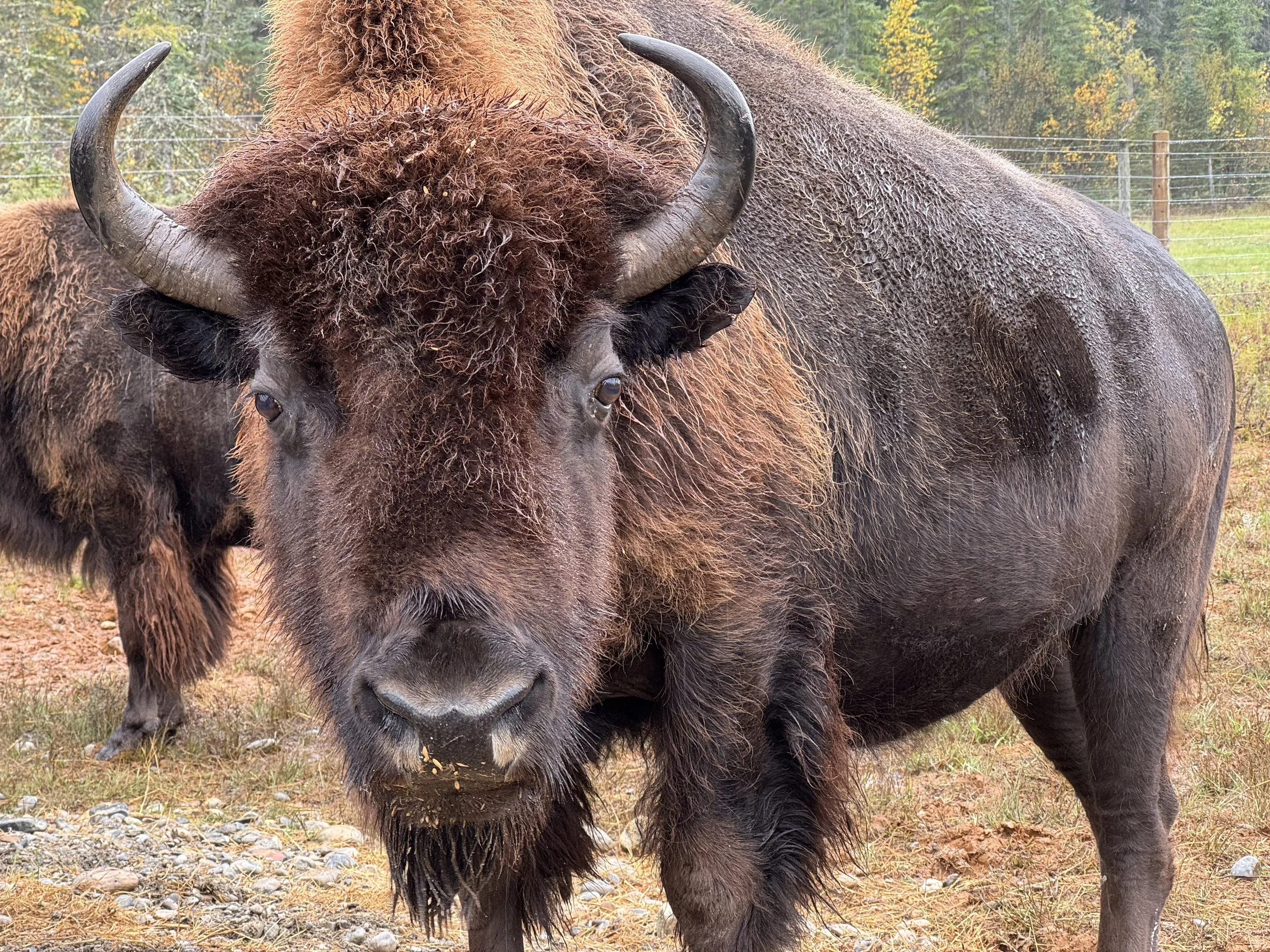
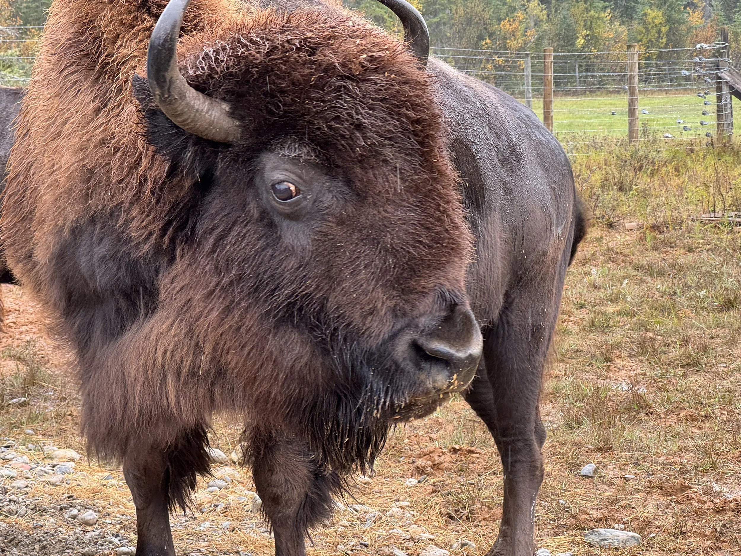
After his presentation, Leo took the group down to his pasture with a large bucket of oats. We stood in an area between two pastures and he dumped some of the oats over the fence. Immediately the herds angriest female came running. She had lost her calf earlier in the season and Leo explained that a “dry cow” gets more unpredictable which makes her more dangerous to be around. The herd lets her eat first. She was followed by the alpha females and then the bull, Chester Jr., the son of Leo’s first bull. Leo will actually go out on to the pasture and feed Chester Jr. from his hand, something that took him years to be able to feel safe doing. We got some great pictures while being only a few inches from these massive animals. We even got to watch a young calf feed from its mother only a few feet away from us.


Leo has an observation platform near his barn that he welcomed us to hang out on after the tour since the herd works its way back after feeding. We hung out there for a few minutes as the rain picked up again. We realized the herd would be moving a great deal slower than we wanted so we called it. We thanked Leo and headed back to our car for the short drive to the Wolf Sanctuary.
The Northern Lights Wildlife Wolf Centre is just a short trip down the road, but the signs aren’t facing the direction that we could see them coming from the Buffalo Ranch so we drove by it and had to turn around. The Wolf Centre houses six adult wolves in three different enclosures. They are all there for different reasons, but all of those reasons preclude them from being released into the wild. There is also a wolf walk available for a pretty hefty price that was described as “life changing” by other guests who have stayed at our B&B but we decided to pass on this one (plus the reservations were booked a year in advance). We listened to the talk about wolves in the area, the work that was done by Canadian wolves to re-balance Yellowstone National Park in the US, and the failing ecosystem of the Canadian Rocky Mountains with the dwindling wolf population. The Canadian government actively promotes the killing of wolves, even allowing the use of poison, and offers bounties on their hides in a misguided attempt to protect the Mountain Cariboo in the region. The chain link fencing used in the enclosures made pictures a little tricky, but I had some decent luck using the 300mm lens when they were further away.
We spent the rest of the day exploring Golden since the weather was pretty nasty and it was going to be our last day in the area. Unfortunately, it was also a holiday, so a lot of the shops were closed. We hit the grocery store and grabbed some easy mac and canned goods for our next stop, because we weren’t sure what our dinner options would be in such a remote location.
Day 12
It was moving day again, today we were headed from Golden to the Saskatchewan River Crossing and The Crossing Resort on the Icefields Parkway. The drive itself would only be about an hour and a half with no stops, but we had plenty of stops scoped out.
We bid farewell to our host at Canyon Ridge Lodge. Again, we couldn’t say enough great things about our stay here, from the excellent breakfast to the cool multi-room setup, laundry room, hot tub, fridge, coffee/tea/water station, and the excellent tips we got from our host. This stay really was a value add for us.
Once we turned onto the Icefields Parkway, our first stop was Herbert Lake. This wasn’t one of ‘the big ones’ but it was the first one we’d see along the parkway so we gave it a go. With it being right off the road, the stop cost us almost no time, but the pictures weren’t great with the conditions, the wind kept us from getting anything reflective.
Our next stop was one of the big ones, Bow Lake. The first overlook had a sizeable layer of trees between us and the lake, but we did manage some pretty good pictures. The selfie stick came in handy more than once on this trip, not just for selfies, but also the extra 6 ft of height it gave us while holding it directly up. The second overlook was right on the lake and offered a different angle. We’d stop here again and get pictures at the lodge on our way out of the park. We knew we were back to the main tourist thoroughfare with a tour bus and a couple of RVs parked here.
Bow Lake upper viewpoint
Bow Lake lower viewpoint
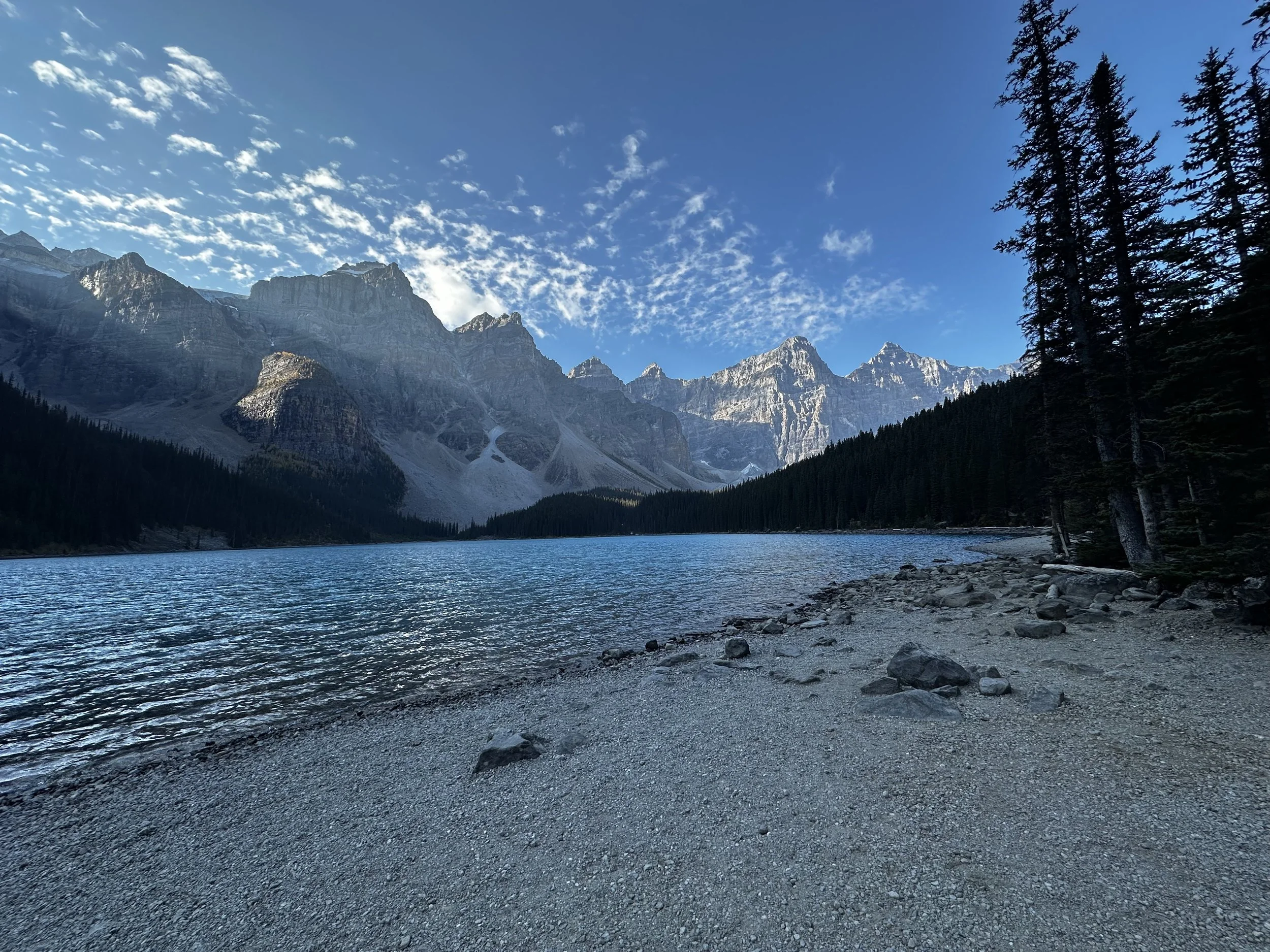
Our third stop in the span of 25 miles was Peyto Lake, and it was finally time to get some steps in. There are two paths up to the top, a longer less steep path and then a shorter one with a pretty solid angle up. The overlook was pretty crowded, but our host had clued us into a secondary overlook down a poorly kept trail that had a lower perch but usually went unnoticed by tourist.
This one wasn’t one of the tourist created paths right next to the sign that says not to pass, it was actually an older path that isn’t as well maintained since the building of the overlook. There is a sign warning people that it’s steep, but the payoff was well worth it as we had the area all to ourselves.
Peyto Lake
Peyto Lake from the lower overlook
Peyto Lake’s crowded overlook
Peyto Creek feeding the lake from snow melt
Our last two lakes of the day were the Waterfowl Lakes. Two lakes that are separated by a short river run and the only bathroom without a huge line for miles. The parking lot for the lower lake isn’t very big, and this area is mostly used for camping, but the campground was closed for the season. We walked along the small river to the Lower Waterfowl Lake for a few pictures with the mountains in the background. Once we made it back to the car, we traveled down the road a bit for pictures from an overlook of the Upper Waterfowl Lake.
Creek between upper and lower Waterfowl lakes
Lower Waterfowl Lake
Lower Waterfowl Lake
Upper Waterfowl Lake
Just before we made it to the Saskatchewan River Crossing, we stopped at Mistaya Canyon. There’s a short steep path that took us down to a bridge over the river and across to the side that was a little easier to climb down. There were plenty of vantage points for pictures and we had to wait out an Instagram model to get the fun one of us looking out at the river with our feet dangling.
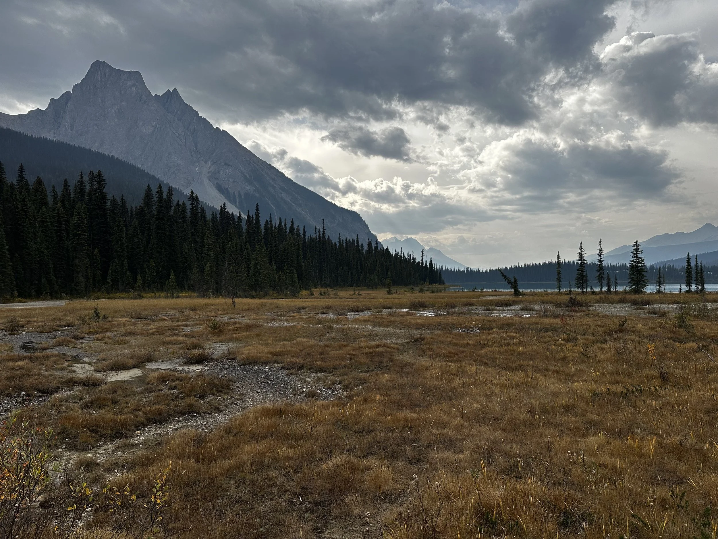
Back on the road and across the Saskatchewan River, we stopped at Howse Pass Viewpoint. This viewpoint looked back across the river and down the valley towards Glacier Lake, but the lake itself is just out of sight. It felt like if we starred at the grasslands by the river for long enough we’d see an animal snacking but, like most of the rest of the trip, the wildlife seems to have moved on.
The Crossing Resort
We checked into our home for the next couple of nights and set out to explore the property a bit. The Crossing Resort has a cafe, gift shop, and gas station that seems to do a healthy business with the tour buses heading north from Banff or south from Jasper. In the evening there’s a sit-down restaurant and a bar on site. We were able to see some of this in our research but weren’t sure about prices, hours, etc. so we brought a few snacks so that we wouldn’t be stuck with only expensive options. Both nights we ended up settling for splitting the chicken strips and fries from the cafe while adding the easy mac we brought to round out the meal. It’s not that the food at the restaurant looked bad, it just ended up feeling overpriced. We also could have eaten at the bar, but their beer options weren’t all that extensive and we’d brought a couple of bottles of wine with us.
That night the KP index hovered right around a favorable number but the cloud cover caused us to think that we were going to miss out on seeing the northern lights however Miranda persisted. Right before we turned in she walked outside and caught a glimpse of some movement in the sky. We got dressed and drove just down the street to the parking lot for Glacier Lake Trail where there were no lights. Outside of the car, we setup a small tripod to get pictures with our phones and some of them turned out quite nice. After a few minutes we heard a grumble from the woods but didn’t give it a ton of thought. After a few more pictures we heard it again and this time it was louder. We both looked at each other and jumped back in the car. We never saw what made the noise, but after a few more minutes, the lights were gone, and we headed back to the hotel.
Day 13
Today is Thursday and the end of the road is in sight. We were going to travel to the northern most point of our trip, the town of Jasper. Initially this wasn’t on our itinerary, but we were so close that it felt like a shame to not get it in. We were up early to see if we could get ahead of the tour buses on their way to the Columbia Icefields Glacier Center. The drive up revealed that it had snowed in the mountains the previous night and we got some fun snow dusted pictures.
The parking lot on the east side of the road was empty so we grabbed a spot and started walking. From the parking lot, there are two paths to the glacier, one is the road, and the other is a hiking trail. We took the trail in and fought the wind most of the way, which made it feel 15-20 degrees colder. We hadn’t actually packed for a cold hike, but our jackets and rain gear kept us warm enough to keep on going. As we got closer to the Athabasca Glacier, we noticed a small lake at the base and we realized that we probably couldn’t get around it. The viewing area itself was empty, the only folks who were in the area were the people going up on the ice cats and a hiking group that looked like they were geared up to be up there all day.
Once we got to the viewing area, we realized that the whole “step foot on a glacier” thing was actually either via one of the ice cat rides or by heading up with a guide and ice spikes. We got our pictures and then returned to the parking lot, this time via the road. Along the way we spotted to markers that showed where the glacier was over the last 100 years.
Not far after the glacier, we stopped to take a look at Tangle Creek Falls. There was a small parking lot that made it easy to stop and get pictures. We’d passed the Columbia Icefield Skywalk, the large tourist trap that offers a glass viewing platform for about $50 a person. We’d already decided against doing this, but the large amount of fog also made it less appealing.
Our next stop would be Sunwapta Falls with its upper and lower viewing areas. The lower area is just a few short steps down a poorly maintained hill with lots of rocks and tree roots exposed. The upper area offers a better view of the falls and the river as it runs downstream. There is another path that goes further into the woods, but we didn’t really know what the payoff would be so we bailed and headed back to the car.
Sunwapta Falls lower viewing area
Sunwapta Falls bridge view
Our last waterfall stop of the day was Athabasca Falls, a large well-kept area with paths that crisscross over the water as it runs through the rocks past the falls. The water empties into a blue lake with cliffs on one side and burned-out trees on the other. This was another popular tour bus stop, and we could see that it would probably be packed during the high season. That can be interesting because some of the path was very narrow.
Back on the road to Jasper, we only had about 20 minutes to drive to reach the outskirts of town. As we approached, we were greeted by a landscape full of burned-out trees and not much else. On the way into town we passed by hundreds of construction sheds and trailers being used by workers who are rebuilding the infrastructure and resorts in the area. The town of Jasper itself seemed to have been spared from the fires over the past two years. We parked near Jasper Brewing Co. for lunch, a beer flight, and then to wander around town. The fish and chips were good and we really enjoyed the beer. Luckily we caught the bar between meals because it was packed by the time we left. We found shirts we liked here and then wandered around before hitting the road.
Our drive back was mostly uneventful, we stopped at the Columbia Icefields Glacier Center for a bathroom break and to look around. It was much busier now with plenty of tour buses, RVs, and cars. We did spot a few mountain goats along the way, just tiny white dots and not too much better with the 300 mm lens. That night we did chicken fingers, fries, and added our easy mac again, why change what isn’t broken? We tried to catch the northern lights again but it was too overcast.
Day 14
We weren’t up too terribly early on our last full day, all we had on the agenda was to hit some of the overlooks we missed on the way in and a brewery or two back in Calgary. Our flight the next day was early so this would be it for the trip. Headed south we got a few good road pictures, but the highlight was one last stop at Bow Lake. We pulled off and parked just short of The Lodge at Bow Lake. It was actually so early that the other drivers who got out when we did all looked at each other, unsure we were allowed to park here. We decided to go with it and found the path to the lake. It was still early enough that the water was calm and the clouds gave us protection from the glare of the sun. We got some great pictures and even had some fun with running to the other side of a panoramic shot. A fallen tree trunk in the lake gave us some fun foreground to work with that was a little different from the large amount of lake and mountain pictures we’d taken so far. Satisfied that we’d gotten everything we could get, we got back in the car and bid farewell to the Icefield Parkway.
Back in Calgary we revisited the idea of stopping at Tool Shed Brewing & BBQ and we ended up being very glad we did. This was the brewery that was closed for an event at the beginning of our trip, but they were open for business when we rolled through this time. We sat at the bar and chatted with the bartenders and one of the owners while we enjoyed their three-meet platter, a flight of beer, and then we both had a pint each. We knew we only had probably one brewery left in us today, so we relaxed and took our time. We made another stop at Walmart so Miranda could pick up some of the maple cookies she’d found earlier in the trip.
Our last brewery ended up being a slight letdown. Not that the brewery was bad or the beer wasn’t good, but with a name like Tailgunner Brewing, I guess I was hoping for a little more of a military theme like Buffalo 9. Instead, it was a bit of a hipster spot with a handful of military items on the wall and pretty limited merch. This was also the last brewery on a two weeklong trip, we were feeling done.
We checked into our hotel and started re-packing. We ended up with a lot of souvenirs on this trip, new hoodies, brewery shirts, and snacks that we picked up along the way. Both of our bags were already hovering around the 45 lbs. mark at the beginning of the trip, so we had to get creative. Both bags eventually clocked in at 50 lbs. with a carry-on each and a Walmart bag full of snacks.
The next morning we were up early and to the airport. We finally found a set of red chairs that weren’t occupied or dirty and snagged a picture in one.
The Banff area was amazing; we felt like we emersed ourselves in the parks and didn’t miss out on much. We learned that British Columbia has a big winery scene, so we might need to check that out soon. All-in-all we put a lot of work and research into this trip and that helped us take advantage of all the time we had which made this well worth it!